The Gulf of Mexico dead zone – a hypoxic area with low oxygen levels that are deadly to fish – is predicted to be smaller than average this summer.
The annual dead zone covers about 5,364 square miles on average, but NOAA has forecasted that the area will be 23 percent smaller this year, covering just 4,155 square miles. The dead zone has occurred every summer for the last six years, caused primarily by excess nutrient pollution from human activities throughout the Mississippi watershed. Those excess nutrients lead to massive algae blooms in the gulf, which deplete oxygen in the water as the algae die, decompose, and sink to the bottom.
The Associate Press reported that low oxygen levels had killed off tens of thousands of fish in the gulf already, with tens of thousands washing up on the Texas coast over the weekend.
This is the sixth year that NOAA has created an aggregate forecast using a suite of models developed in partnership with researchers from the University of Michigan, Louisiana State University, William & Mary’s Virginia Institute of Marine Science, North Carolina State University, and Dalhousie University. The models use data from the U.S. Geological Survey, which collects discharge and nutrient loading data from the month of May to help determine the size of the dead zone. This year, discharge was about 33 percent below the long-term average and nitrate loads were about 42 percent below the long-term average.
“NOAA hypoxia forecasts aim to provide coastal managers and stakeholders with the information they need to take proactive action to mitigate the impacts of hypoxic events,” NOAA National Ocean Service Assistant Administrator Nicole LeBoeuf said. “These forecasts also help managers set nutrient reduction targets necessary to reduce the frequency and magnitude of future dead zones.”
NOAA will also conduct a monitoring survey to assess the size of the dead zone this summer, using the results to improve its modeling. The forecasts aren’t always spot on – in 2021 the agency’s forecast was off by 1,454 square miles.
Money in the Bipartisan Infrastructure Law is being used to address the issue, with the Interagency Mississippi River and Gulf of Mexico Hypoxia Task Force working to reduce the dead zone to 1,900 square miles by 2035. The teams use the U.S. Geological Survey data and NOAA’s forecast to inform their nutrient reduction targets across the Mississippi watershed.
“With new investments from the Bipartisan Infrastructure Law, the Hypoxia Task Force is taking action to accelerate nutrient load reductions from the Mississippi River Basin and reduce the size of the hypoxic zone,” U.S. Environmental Protection Agency Office of Wetlands, Oceans, and Watersheds Director Brian Frazer said. “Together the task force will continue to tackle the challenge of Gulf Hypoxia. This annual forecast is a key metric that informs our collective efforts.”
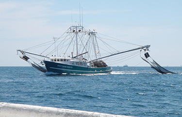
Photo courtesy of NOAA Fisheries


